Land Auction - 787.27 +/- Acres In Nance County, Ne, Offered In 5 Tracts
Land Auction - 787.27 +/- Acres in Nance County, NE, Offered in 5 Tracts
- Farm
- Farm Auction
- Land Auction
- Irrigated
- Hunting
- Pivot Irrigation
- Grain Storage
- Work Shop
- Water Wall
- Hwy/County Rd Frontage
 View Map
Descriptions
Live & Online Land Auction
787.27 +/- Acres
Nance County, NE
Tuesday, April 9th
10:00 a.m.
Eagles Club
327 Broadway Street
Fullerton, NE 68638
Bid Online at:Bid.AgWestLand.com
AgWest Land Brokers is proud to offer 5 tracts of highly productive farm ground in Nance County, Nebraska. These farms would make a great addition to any farming operation and are open for the 2024 growing season.
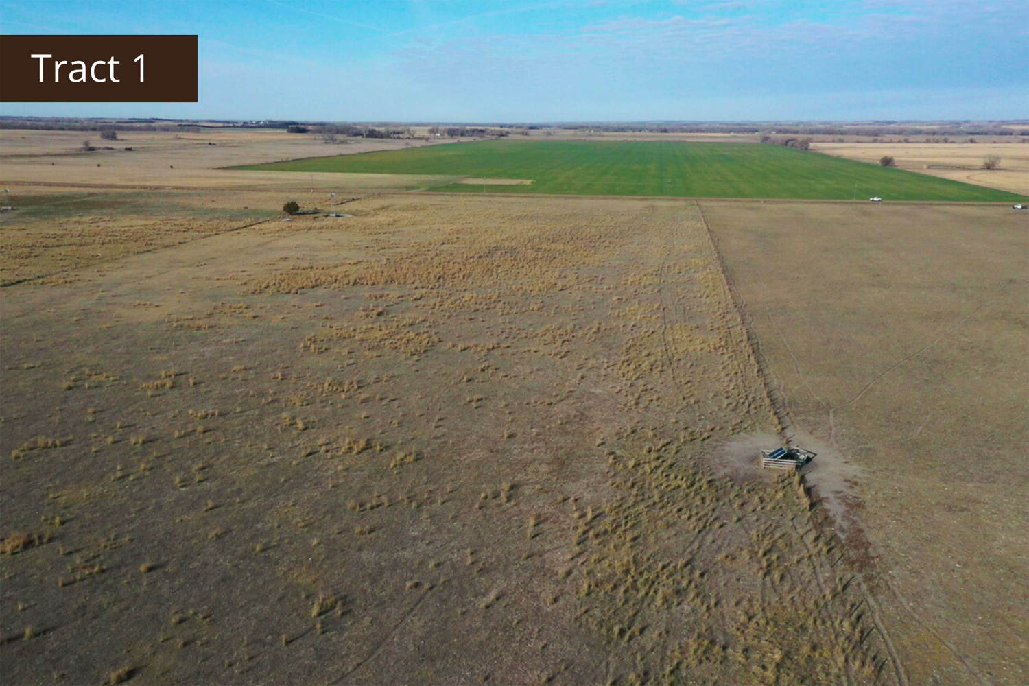
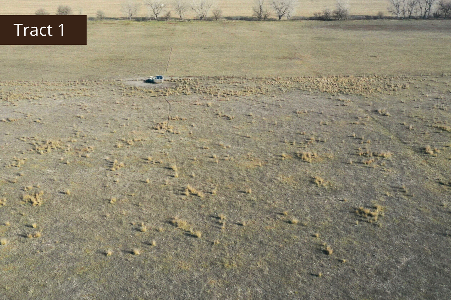
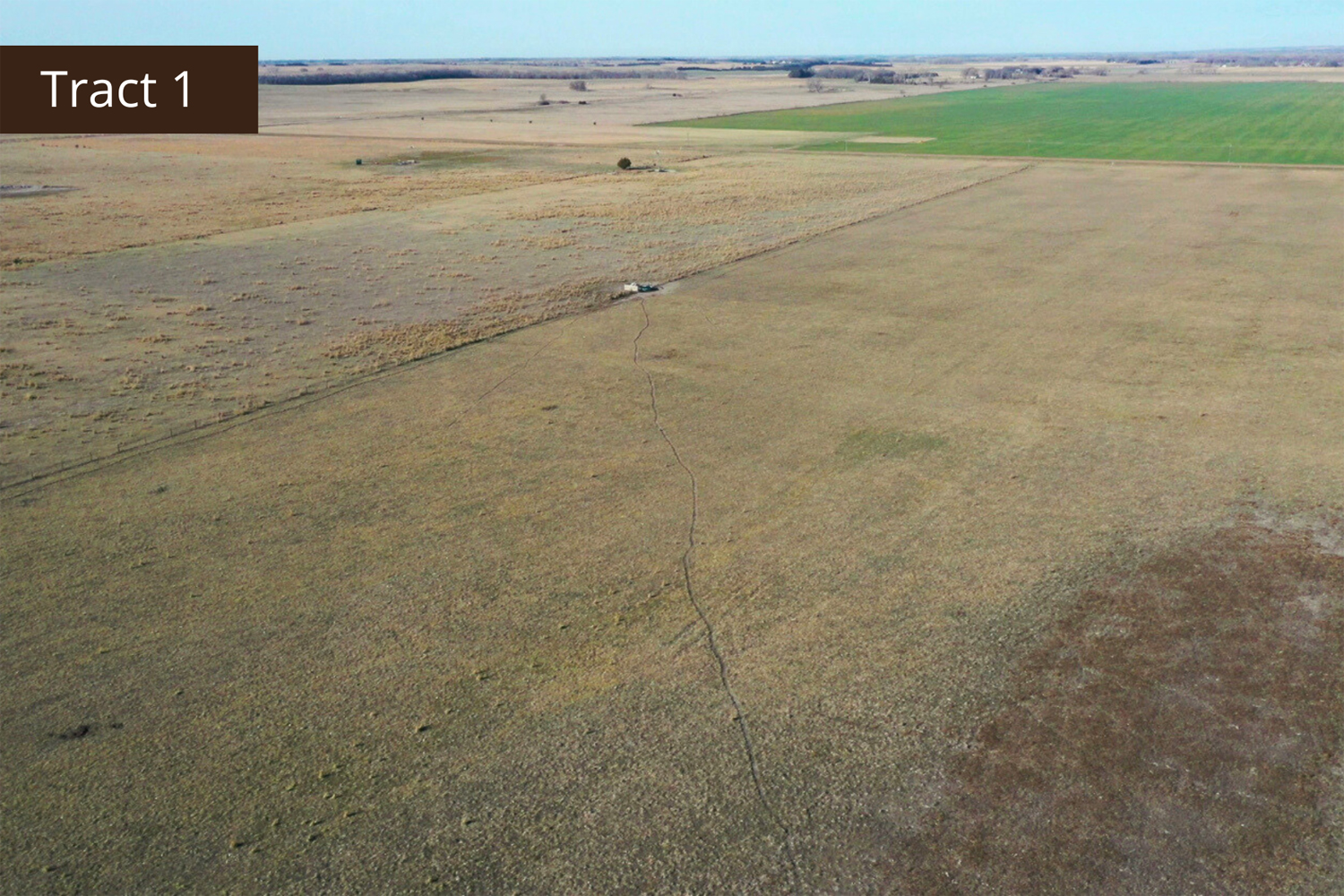
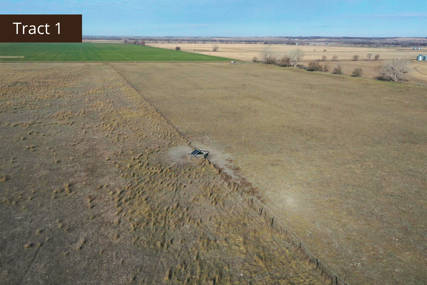
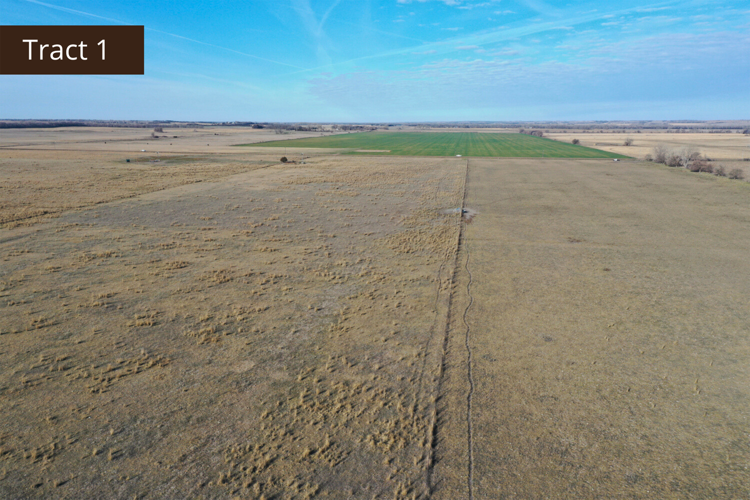
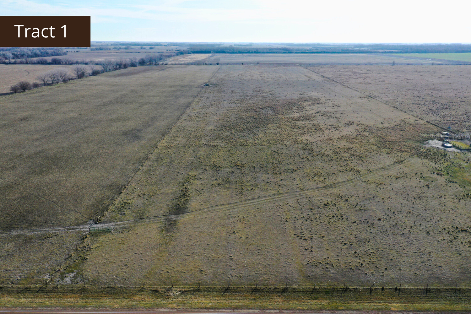
Tract 1 Details
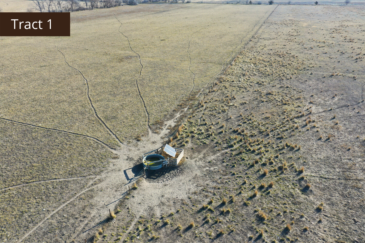
Located conveniently off the main highway, this hard-to-find pasture boasts excellent grass and a solar pump for water supply. With great fencing and availability for the 2024 grass season, this property is perfect for expanding your cattle herd.
Total Acres (Per Assessor) 69.94 +/-
Grass Acres 68.0 +/-
Other Acres 1.94 +/-
Legal Description
Pt. of the N1/2 of SW1/4 Section 35, Township 16 North, Range 6 West, West Newman 144
Property Taxes - $ 1,349.18
Irrigation Equipment
Solar-powered cattle pump
1 - Irrigation well
Other information
Fences are in great shape
FSA Information
Total Cropland Acres: 69.47 +/-
Corn - 53.4 Base Acres - 109 PLC Yield
Soybeans - 5.1 Base Acres - 33 PLC Yield
Wheat - 0.9 Base Acres - 35 PLC Yield
Grain Sorghum - 0.1 Base Acres - 64 PLC Yield
Total Base Acres - 59.5
Property Directions
Take Highway 14 south of Fullerton roughly 2 1/2 miles. The property is located on the east side of Highway 14.
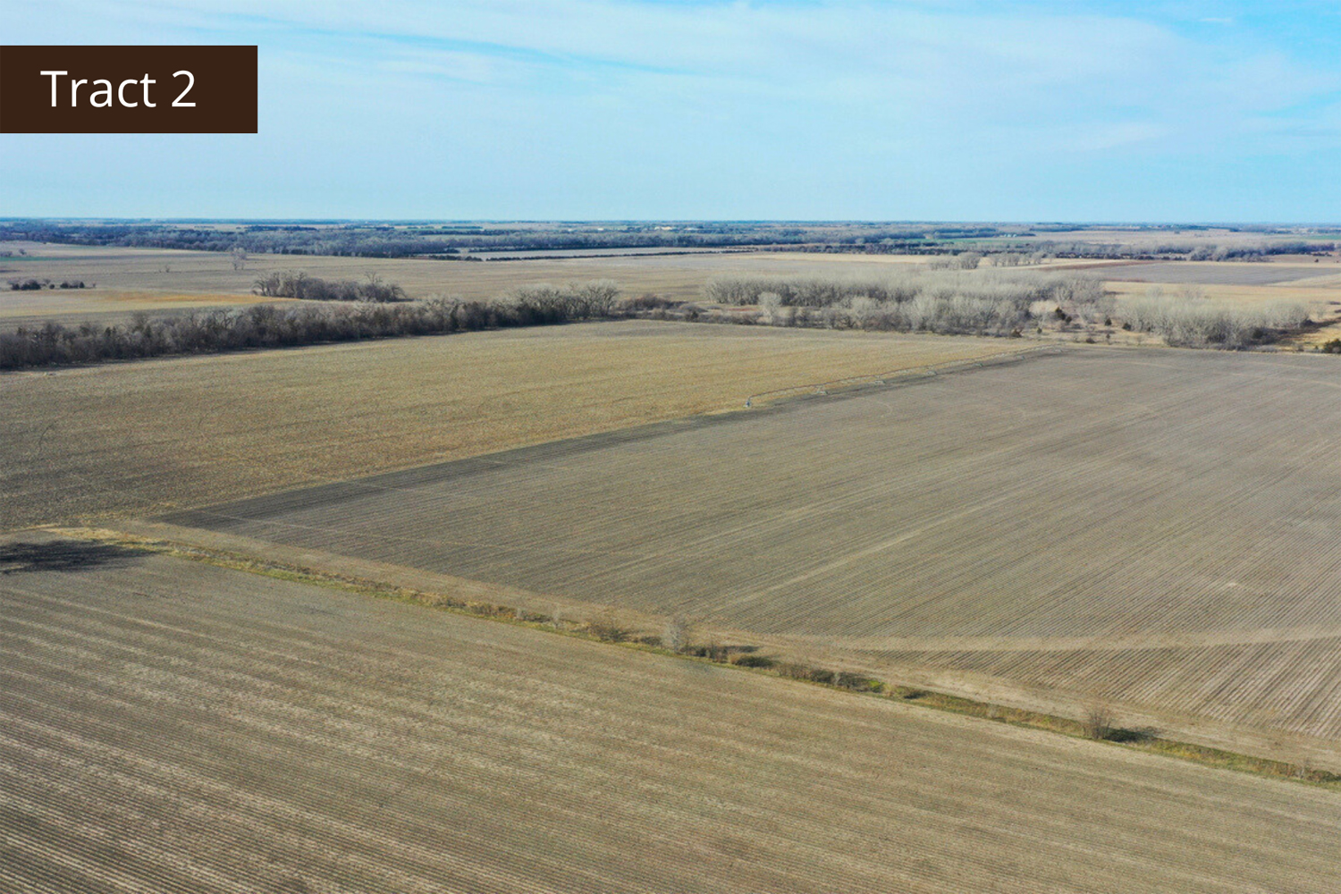
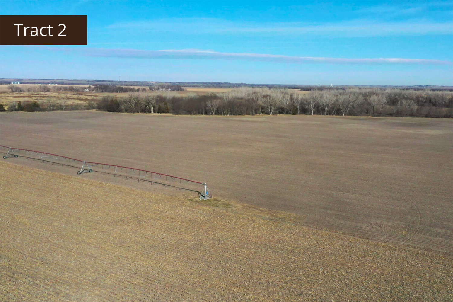
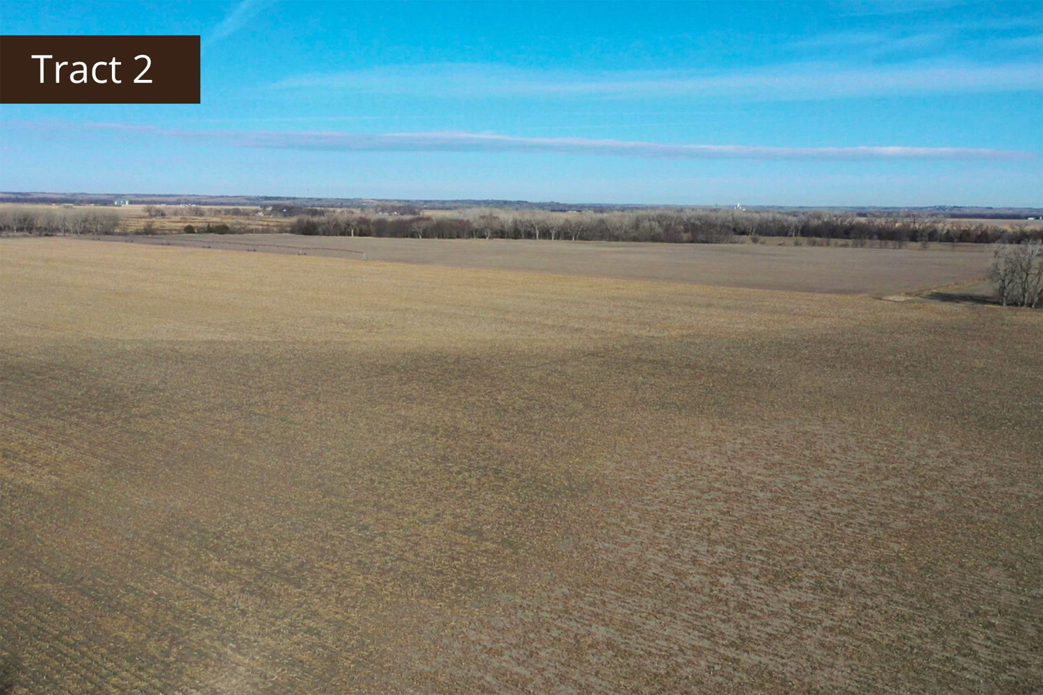
Tract 2 Details
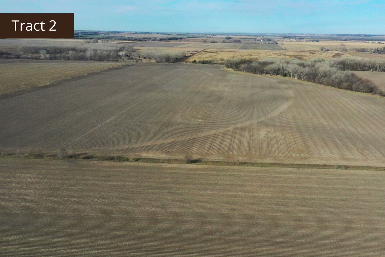
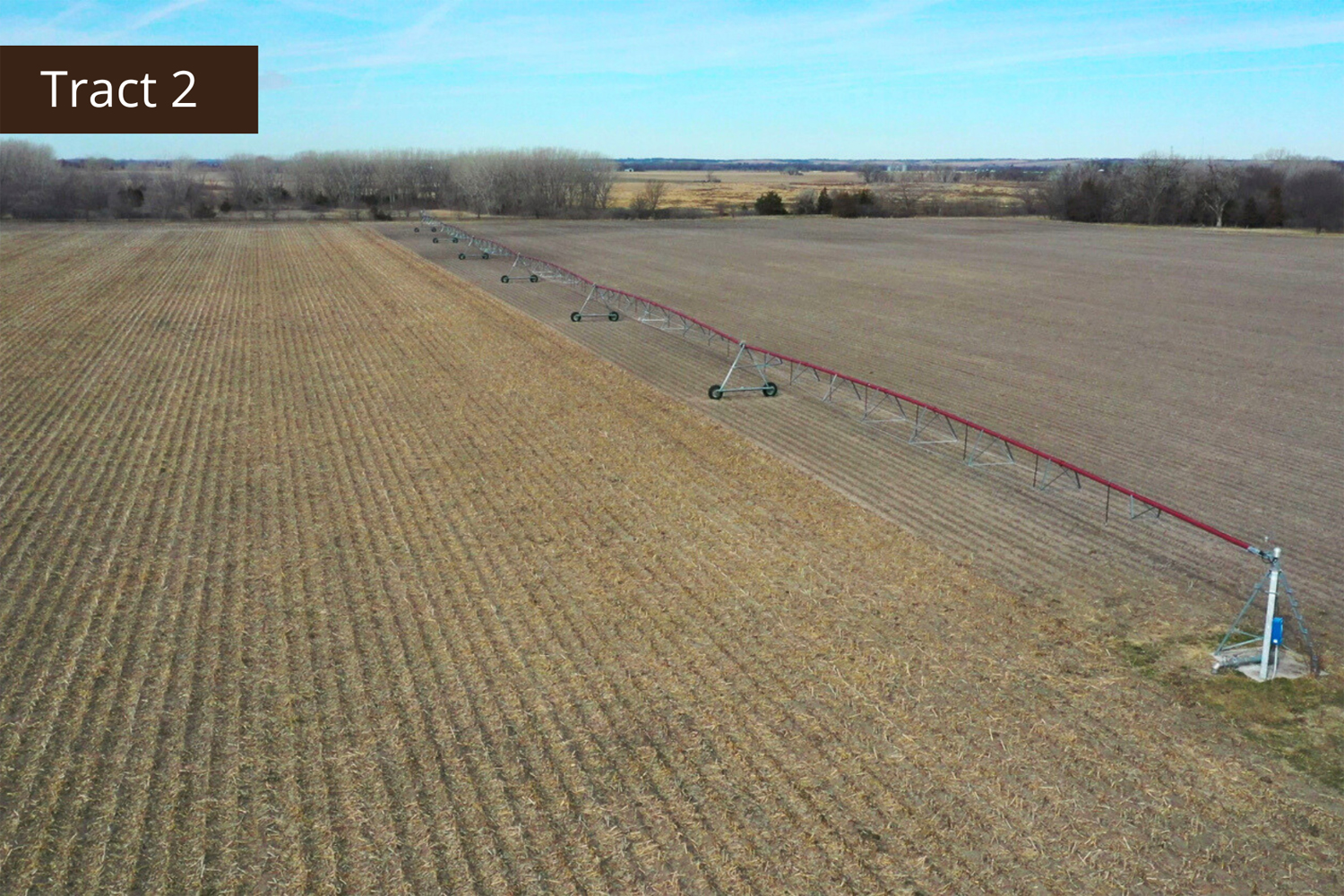
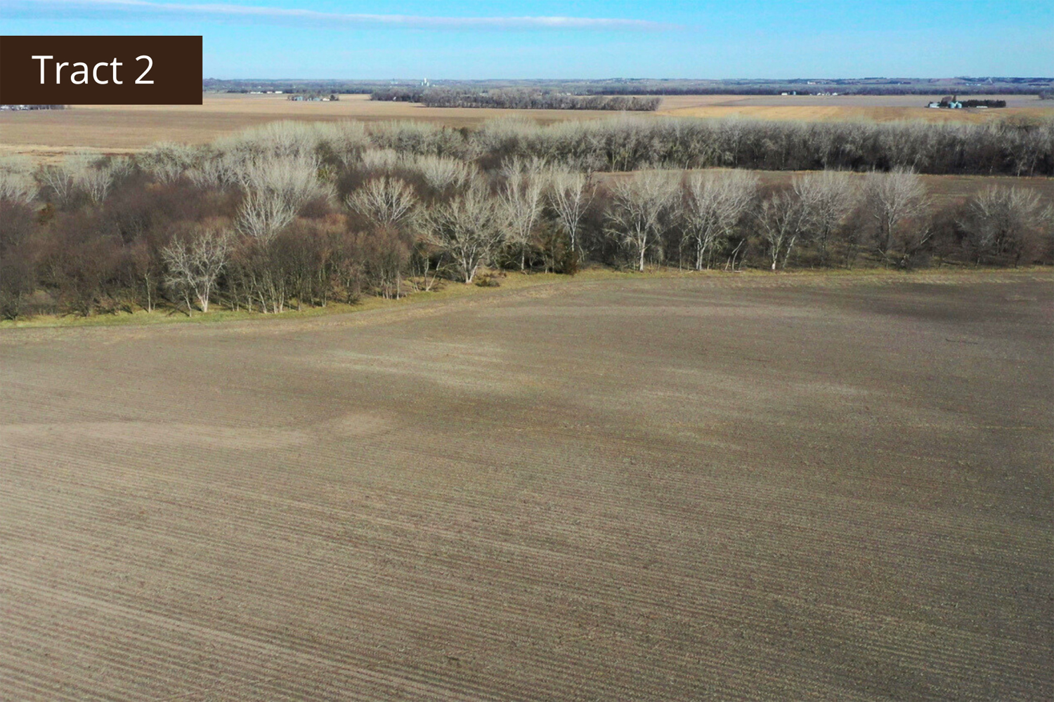
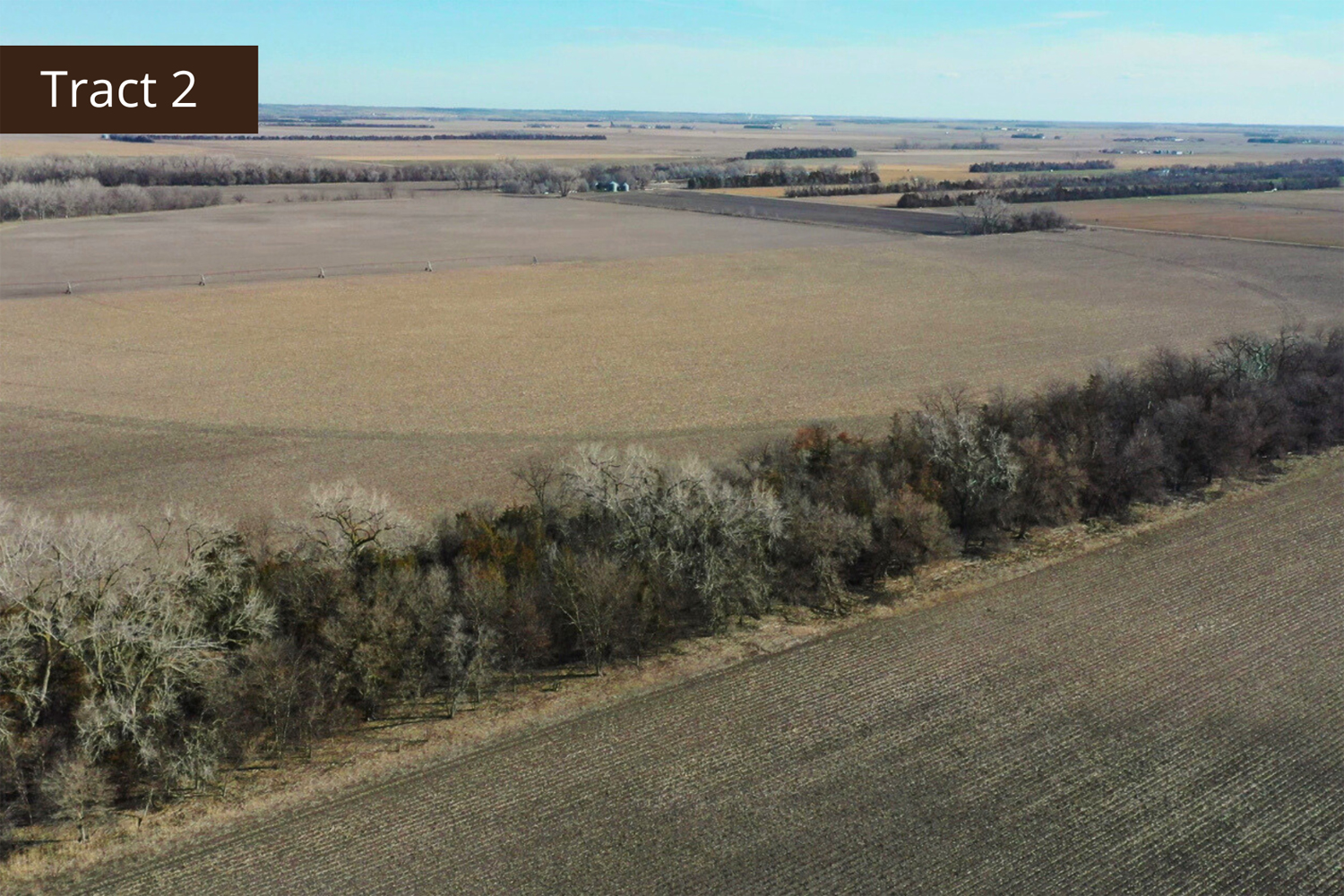
This is a productive, pivot irrigated tract of land, with most of the farm having certified irrigated acres. This is a certified organic tract of land that is conveniently located near elevators and ethanol plants. The pivot system is well-maintained. The northwest corner of the property is an ideal spot for deer hunting. A survey will be conducted to determine exact acres and boundaries.
Total Estimated Acres - 205 +/-
Irrigated Acres - 135.96 +/-
Dryland Acres - 39.04 +/-
Grass Acres - 15 +/-
Recreational Acres - 13 +/-
Other Acres - 2 +/-
Legal Descriptions
Pt. of the SE1/4 of Section 31, Township 16 North, Range 5 West, East Newman 137
NE1/4 of Section 31, Township 16 North, Range 5 West, East Newman 137
Estimated Property Taxes - $ 8,801.82
Irrigation Information
Located in the Central Platte NRD and has certified irrigation rights for 135.96 acres.
Irrigation Equipment
Reinke center pivot
13 - Irrigation wells
Estimated FSA Information
Total Cropland Acres: 172.12 +/-
Corn - 132.12 Base Acres - 125 PLC Yield
Soybeans - 11.94 Base Acres - 33 PLC Yield
Wheat - 2.12 Base Acres - 35 PLC Yield
Grain Sorghum - .14 Base Acres - 65 PLC Yield
Total Base Acres - 146.32
Property Directions
Go south of Fullerton on Highway 14 to 555th Road. Turn and go east approximately 2 miles to 290th Avenue. Turn and go south roughly 2 1/2 miles. The property is on the west side of the road.
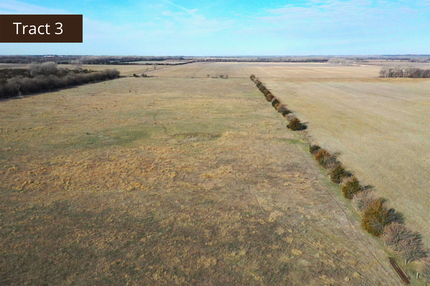
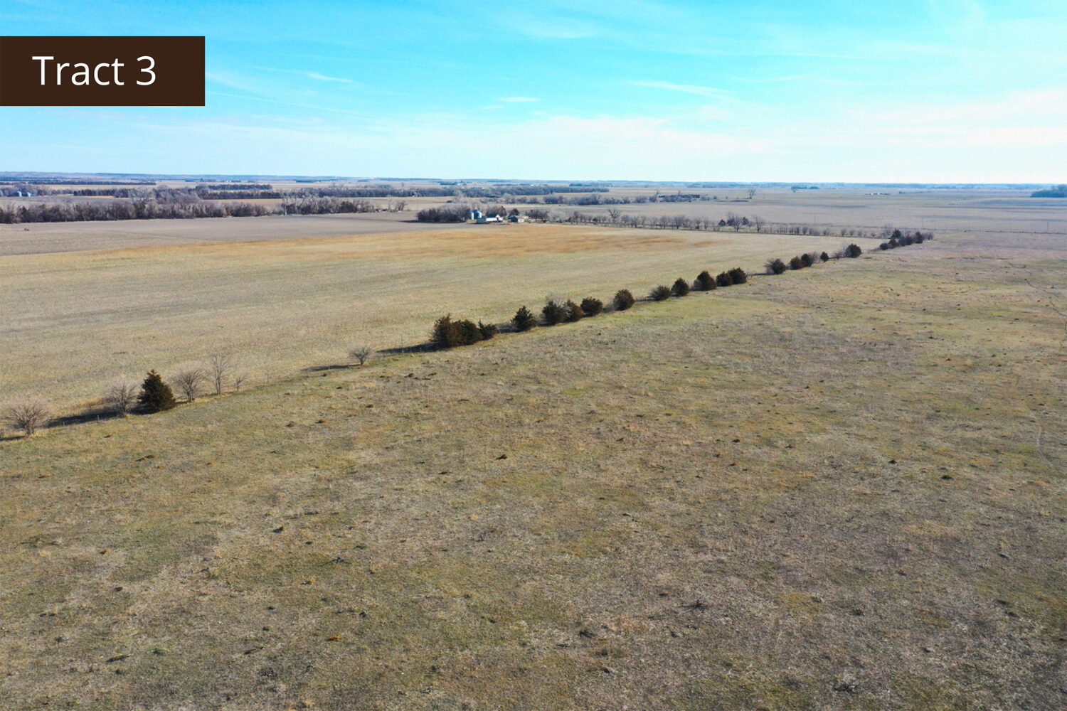
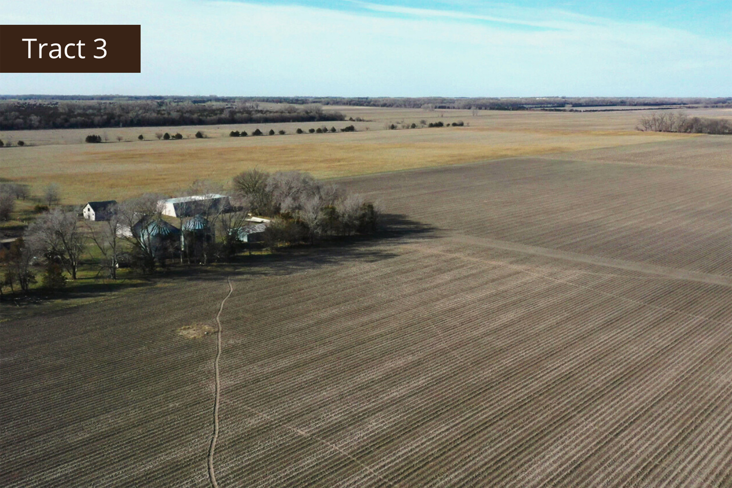
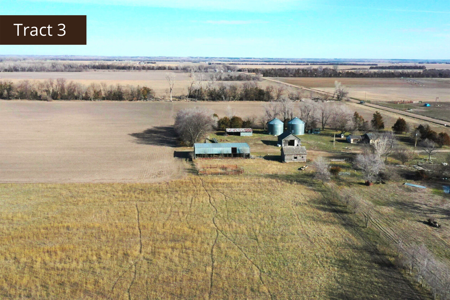
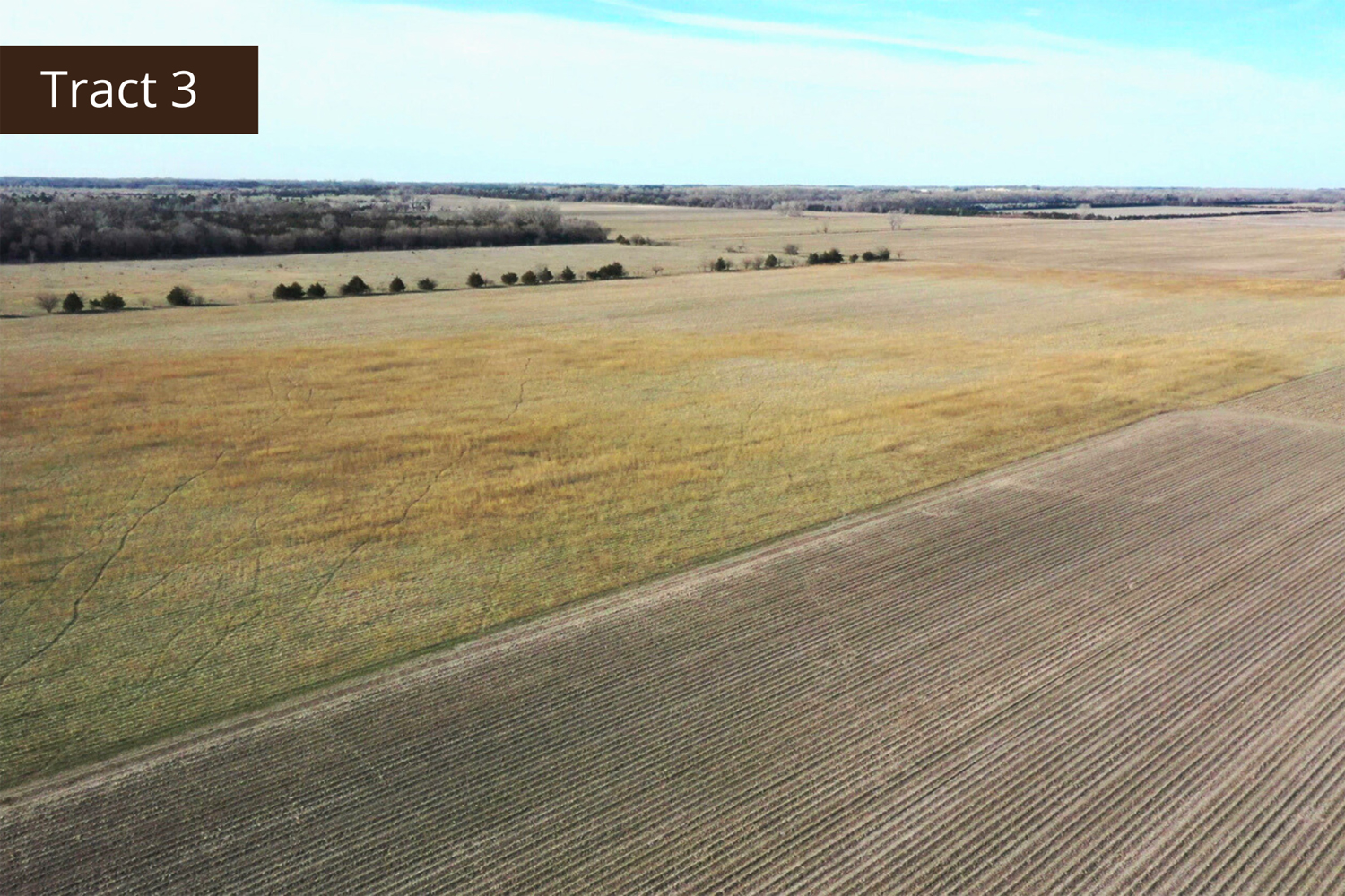
Tract 3 Details
This is a certified organic tract of land that would be a perfect fit for the first-time organic farmer looking for grass for livestock and farm ground. The property has an old building site that can be renovated to accommodate both livestock and crops. A survey will be conducted to determine exact acres and boundaries.
Total Estimated Acres - 115 +/-
Dryland Acres - 57.28 +/-
Grass Acres - 51.85 +/-
Other Acres - 5.87 +/-
Legal Description
Pt. of the SE1/4 of Section 31, Township 16 North, Range 5 West, East Newman 137
Estimated Property Taxes - $ 2,008.00
Other Information
Grain bins in good condition.
Good fence around the pasture.
Outbuildings in rough condition.
Estimated FSA Information
Total Cropland Acres: 61.96 +/-
Corn - 47.88 Base Acres - 125 PLC Yield
Soybeans - 4.56 Base Acres - 33 PLC Yield
Wheat - 0.78 Base Acres - 35 PLC Yield
Grain Sorghum - 0.6 Base Acres - 65 PLC Yield
Total Base Acres - 53.82
Property Directions
Go south of Fullerton on Highway 14 to 555th Road. Turn and go east approximately 2 miles to 290th Avenue. Turn and go south roughly 3 miles. The property is on the west side of the road.
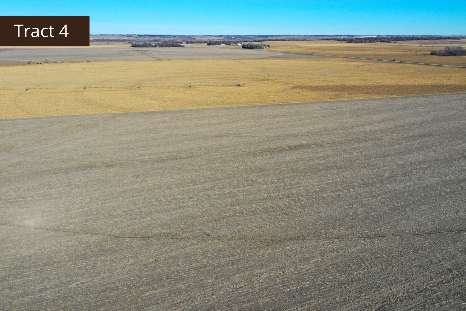
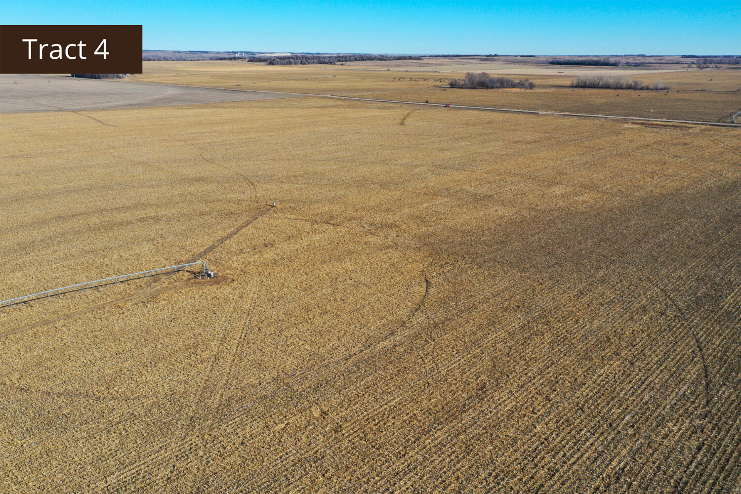
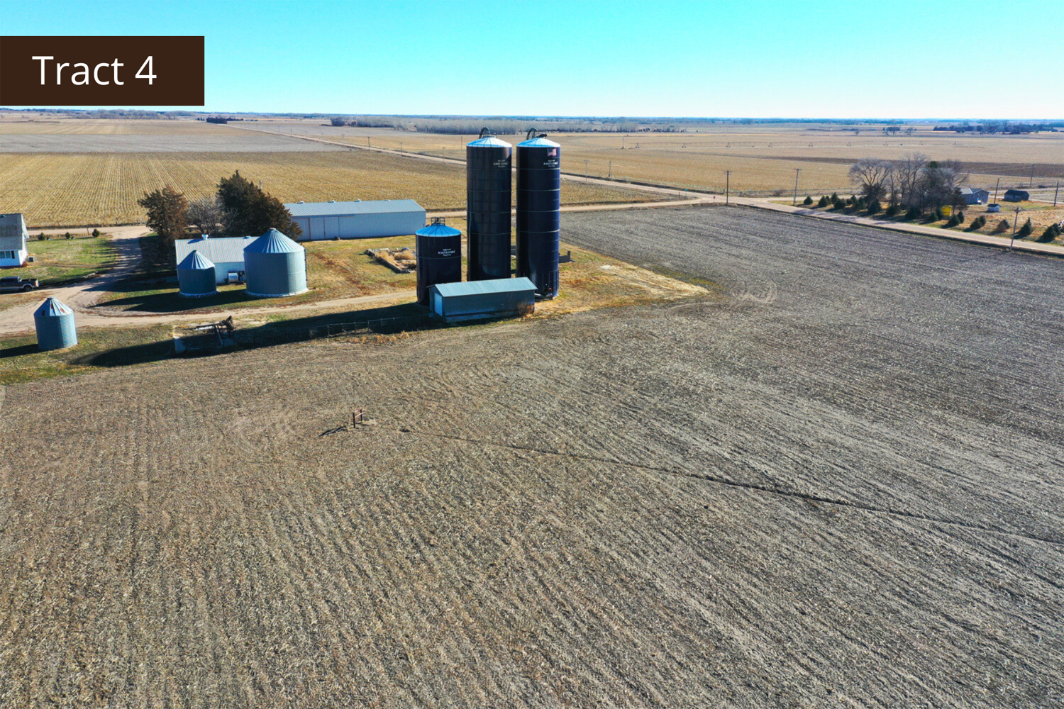
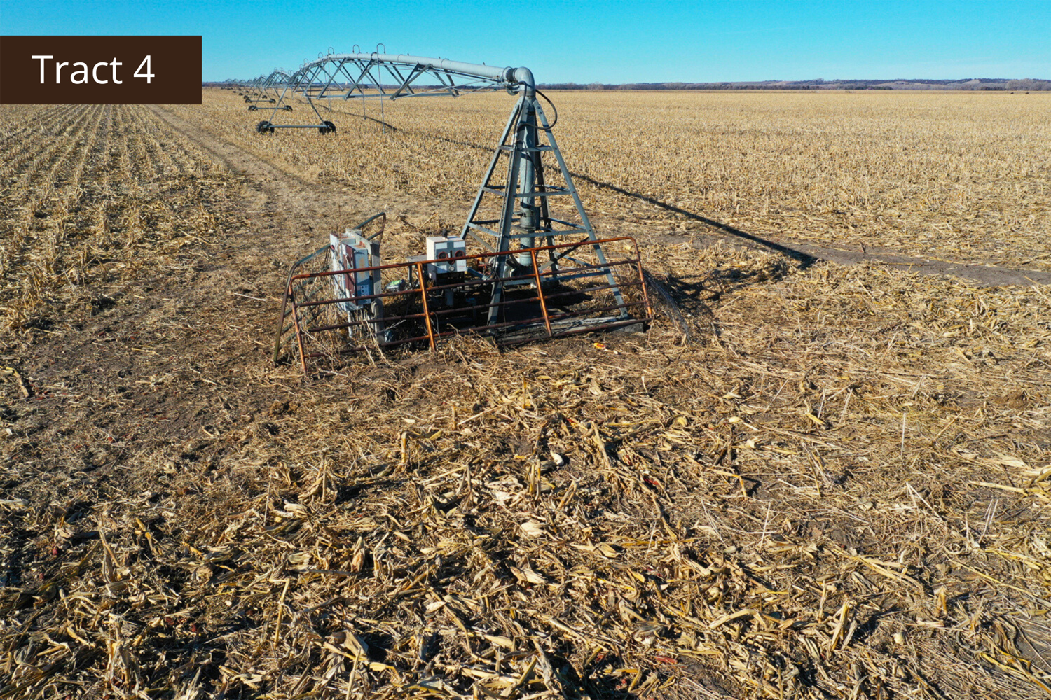
Tract 4 Details
This is a highly productive, pivot-irrigated quarter with a machine shed, outbuilding, and 3 silos. If expanding your operation is in your plans, come take a look at this farm.
Total Acres (Per Assessor) - 157.33 +/-
Irrigated Acres - 141.3 +/-
Dryland Acres - 6.33 +/-
Grass Acres - 1.78 +/-
Other Acres - 7.92 +/-
Legal Description
Pt. of the SE1/4 of Section 15, Township 16 North, Range 5 West, East Newman 133
Property Taxes - $ 7,528.76
Irrigation information
Located in the Central Platte NRD and has certified irrigation rights for 141.3 acres.
Irrigation Equipment
T&L irrigation pivot
12 - Irrigation wells
Additional Information
The acreage next to tract 4 is not included in the auction but has an irrigation well for tract 4. A credit will be given to the buyer in the amount of $26,150 (per a bid from Grosch Irrigation) for the drilling of a new well and pump on tract 4. There currently is a drill permit, but the irrigation company could not get the work done prior to the auction. The buyer will have access to the existing well on the acreage until the new well is drilled. Any repairs needed for the well will be the responsibility of the buyer.
FSA Information
Total Cropland Acres: 152.03 +/-
Corn - 112.9 Base Acres - 125 PLC Yield
Soybeans - 10.2 Base Acres - 42 PLC Yield
Wheat - 1.8 Base Acres - 35 PLC Yield
Grain Sorghum - 0.1 Base Acres - 64 PLC Yield
Total Base Acres 125
Property Directions
Take Highway 14 south of Fullerton to 555 Road. Go east roughly 2 miles to 280th Avenue. Go 1/2 mile north to S. 550th Street. Travel east on S. 550th Street approximately 3 miles. The property is located on the north side of the road.
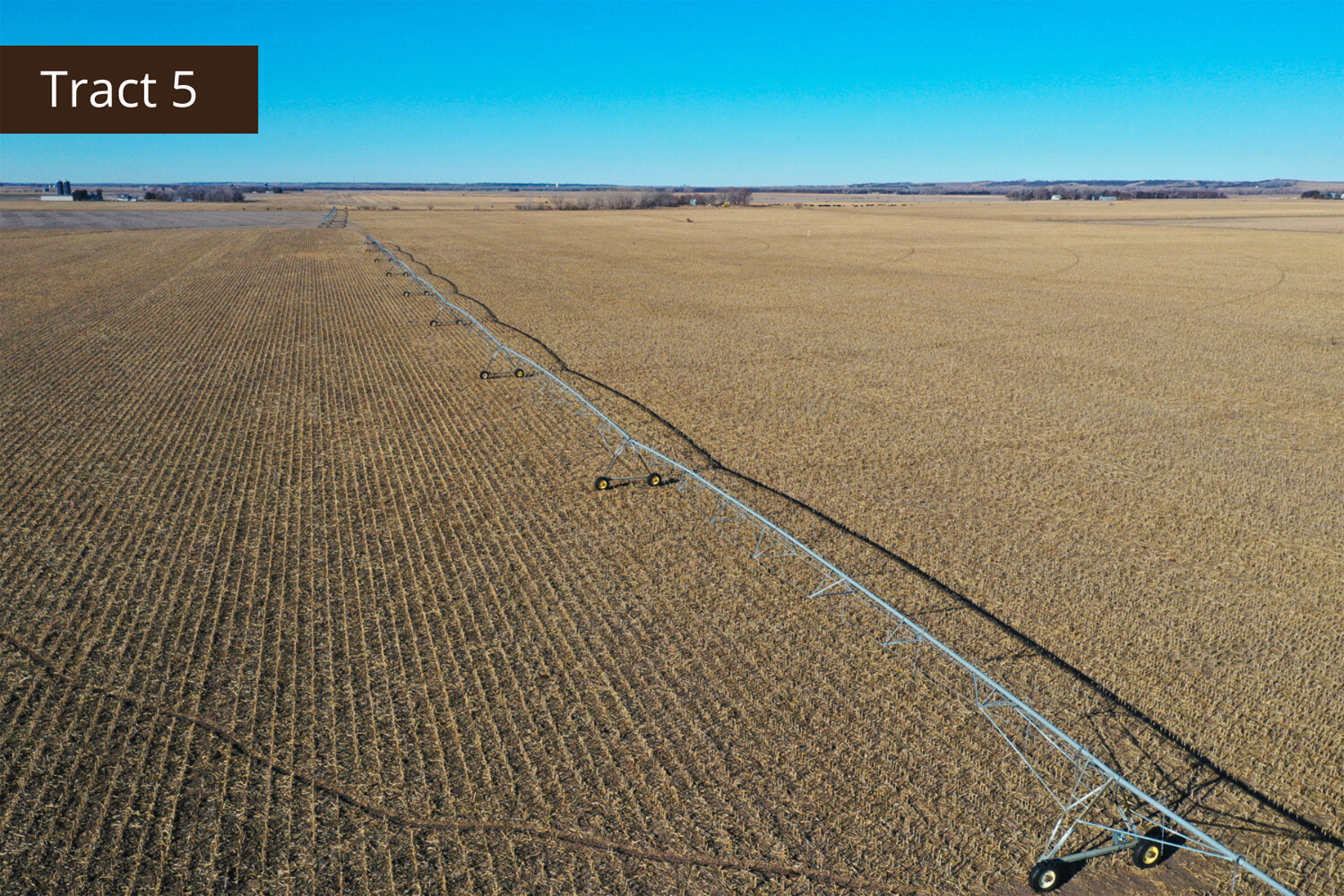
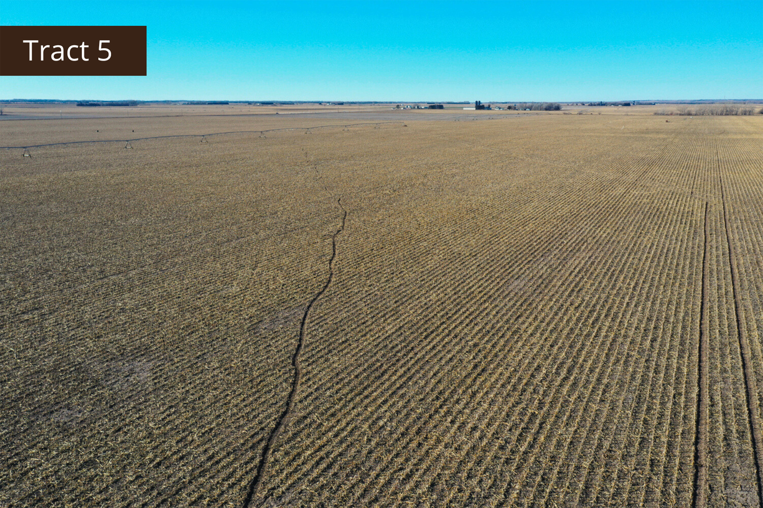
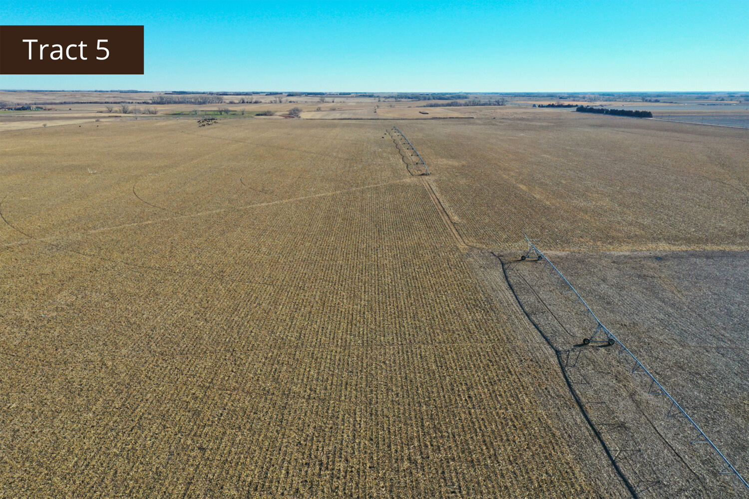
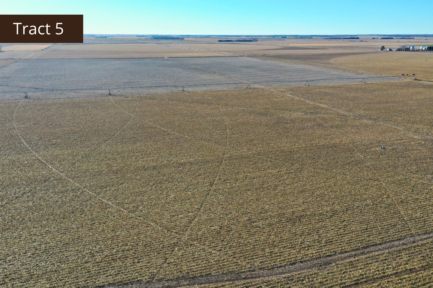
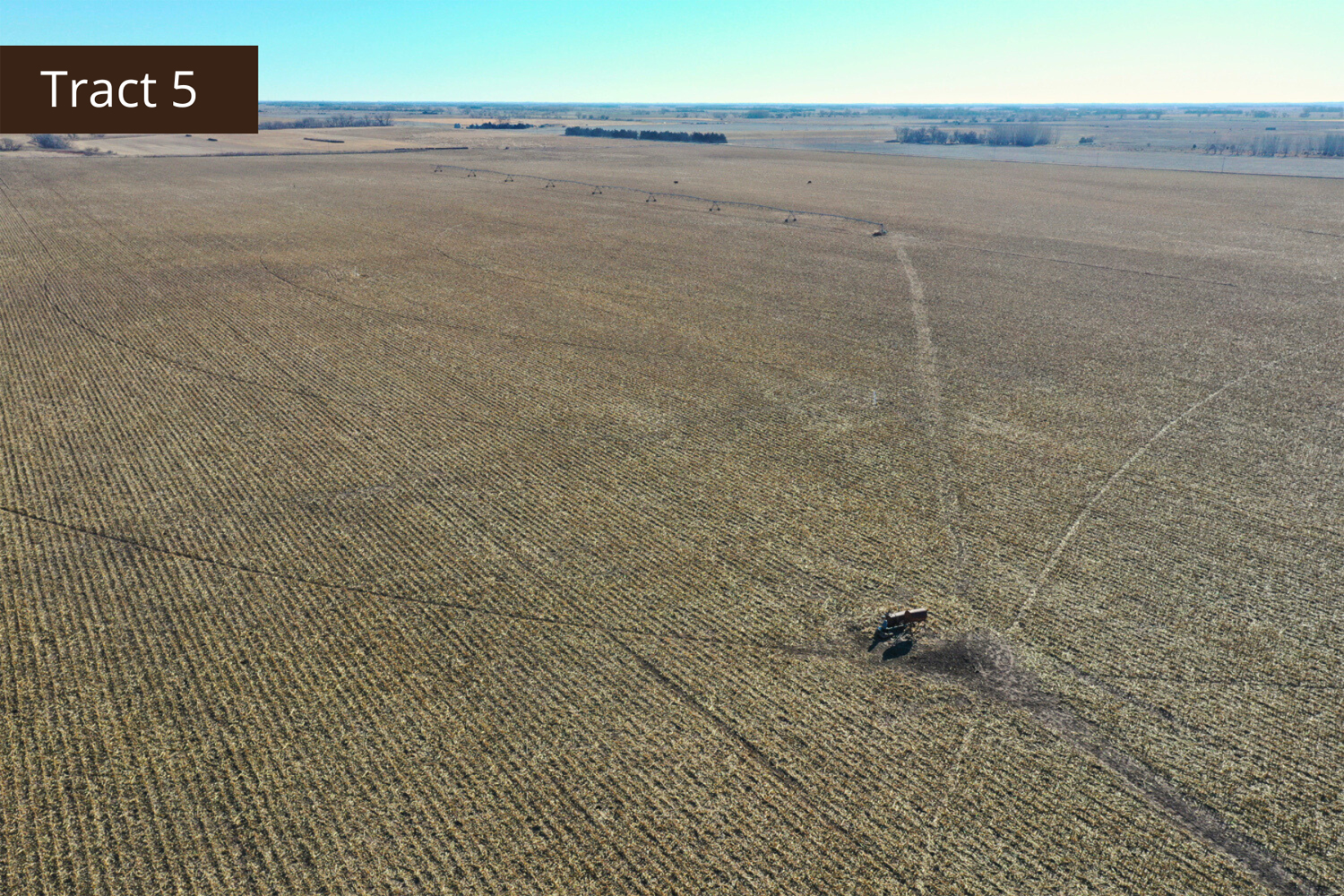
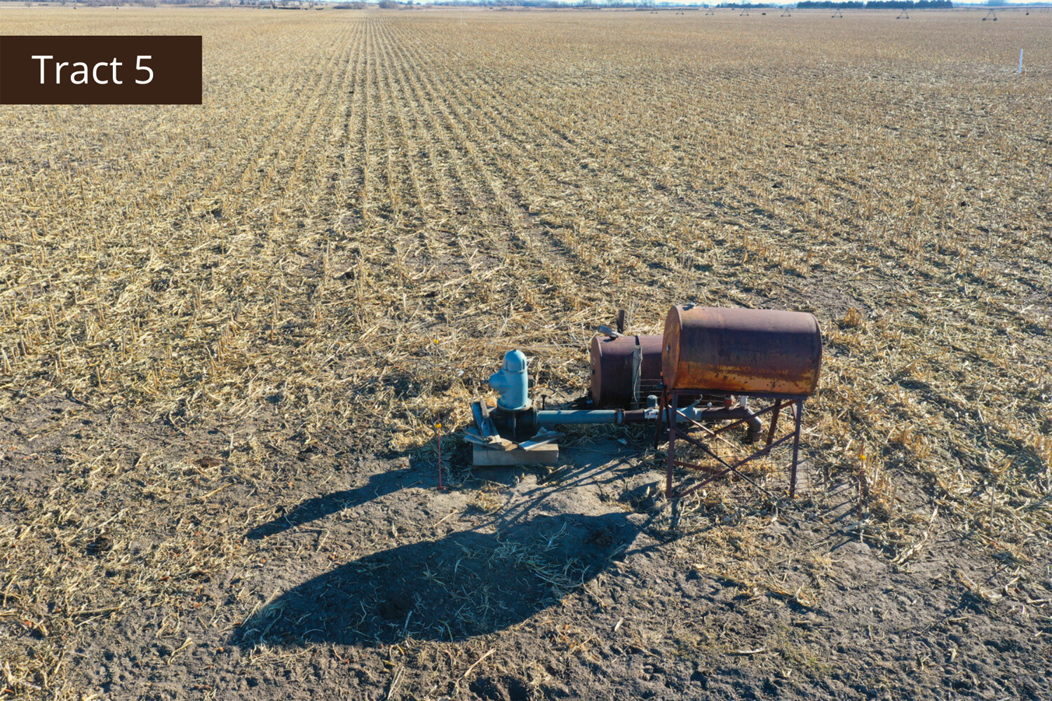
Tract 5 Details
This sizable tract of farmland offers two pivots for irrigation, is situated close to various elevators and ethanol plants, and would be a great addition for someone looking to expand their operation.
Total Acres (Per Assessor) - 240 +/-
Irrigated Acres - 181.43 +/-
Dryland Acres - 58.57 +/-
Other Acres - 5.0 +/-
Legal Descriptions
E1/2 of SW1/4 Section 14 Township 16 North, Range 5 West, East Newman 132
SE1/4 of Section 14, Township 16 North, Range 5 West, East Newman 132
Property Taxes - $ 9,894.48
Irrigation Information
Located in the Central Platte NRD and has certified irrigation rights for 181.43 acres.
Irrigation Equipment
2 - T&L irrigation pivots
26 - Irrigation wells
FSA Information
Total Cropland Acres: 237.26 +/-
Corn - 164.10 Base Acres - 125 PLC Yield
Soybeans - 22.3 Base Acres - 42 PLC Yield
Wheat - 7.7 Base Acres - 35 PLC Yield
Grain Sorghum - 0.2 Base Acres - 64 PLC Yield
Total Base Acres - 194.3
Property Directions
Take Highway 14 south of Fullerton to 555 Road. Go east roughly 2 miles to 280th Avenue. Go 1/2 mile north to S. 550th Street. Travel east on S. 550th Street approximately 3 1/2 miles. The property is located on the north side of the road.
Well Information
Well data is per the Nebraska well registration from the Nebraska Department of Natural Resources.
Tract 1 1 Irrigation well
Well G-189365, drilled 3/3/2020, 5 GPM, 2' static level, 5' pumping level, 17' well depth.
Tract 2 13 Irrigation wells
Well G-122732A, drilled 4/1/1970, 50 GPM, 10' static level, 22' pumping level, 24' well depth.
Well G-122731A, drilled 9/23/1975, 400 GPM, 4' static level, 20' pumping level, 26' well depth.
Well G-122732B, drilled 4/1/1970, 75 GPM, 10' static level, 22' pumping level, 24' well depth.
Well G-122732C, drilled 4/1/1970, 75 GPM, 10' static level, 22' pumping level, 24' well depth.
Well G-122731D, drilled 10/1/1975, 50 GPM, 4' static level, 20' pumping level, 24' well depth.
Well G-122731B, drilled 9/23/1975, 400 GPM, 4' static level, 20' pumping level, 26' well depth.
Well G-122731C, drilled 10/1/1976, 50 GPM, 4' static level, 4' pumping level, 12' well depth.
Well G-122730A, drilled 1/1/1969, 200 GPM, 4' static level, 20' pumping level, 24' well depth.
Well G-122731E, drilled 10/1/1976, 50 GPM, 4' static level, 20' pumping level, 24' well depth.
Well G-122729, drilled 1/1/1980, 30 GPM, 4' static level, 4' pumping level, 12' well depth.
Well G-122730D, drilled 10/1/1975, 100 GPM, 4' static level, 20' pumping level, 24' well depth.
Well G-122730B, drilled 1/1/1969, 200 GPM, 4' static level, 20' pumping level, 24' well depth.
Well G-122730C, drilled 10/1/1975, 60 GPM, 4' static level, 20' pumping level, 24' well depth.
Tract 4 12 Irrigation wells
Well G-042150A, drilled 9/14/1971, 500 GPM, 6' static level, 20' pumping level, 26' well depth.
Well G-042150B, drilled 9/1/1971, 300 GPM, 6' static level, 18' pumping level, 21' well depth.
Well G-028581A, drilled 6/1/1960, 700 GPM, 9' static level, 23' pumping level, 25' well depth.
Well G-028581B, drilled 6/1/1960, 9' static level, 23' pumping level, 27' well depth.
Well G-028581C, drilled 5/1/1978, 100 GPM, 10' static level, 22' pumping level, 24' well depth.
Well G-028581D, drilled 5/1/1978, 75 GPM, 10' static level, 22' pumping level, 24' well depth.
Well G-028581E, drilled 5/1/1978, 150 GPM, 10' static level, 22' pumping level, 24' well depth.
Well G-028581F, drilled 5/1/1978, 150 GPM, 10' static level, 22' pumping level, 24' well depth.
Well G-028581G, drilled 5/1/1978, 150 GPM, 10' static level, 22' pumping level, 24' well depth.
Well G-028582A, drilled 11/10/1961, 300 GPM, 6' static level, 19' pumping level, 25' well depth.
Well G-028582B, 11/10/1961, 6' static level, 19' pumping level, 21' well depth.
Well G-028582C, drilled 11/10/1961, 6' static level, 19' pumping level, 25' well depth.
Tract 5 26 Irrigation wells
Well G-122728A, drilled 10/1/1985, 175 GPM, 8' static level, 4' pumping level, 20' well depth.
Well G-122728B, drilled 10/1/1985, 75 GPM, 8' static level, 4' pumping level, 20' well depth.
Well G-122728C, drilled 10/1/1985, 50 GPM, 8' static level, 4' pumping level, 20' well depth.
Well G-122728D, drilled 1/10/1985, 75 GPM, 8' static level, 4' pumping level, 20' well depth.
Well G-122728E, drilled 10/1/1985, 150 GPM, 8' static level, 4' pumping level, 20' well depth.
Well G-020644A, drilled 7/25/1959, 425 GPM, 9' static level, 17' pumping level, 21' well depth.
Well G-020644B, drilled 4/1/1960, 50 GPM, 10' static level, 18' pumping level, 20' well depth.
Well G-020644C, drilled 4/1/1960, 75 GPM, 10' static level, 18' pumping level, 20' well depth.
Well G-020644D, drilled 10/1/1970, 150 GPM, 8' static level, 8' pumping level, 26' well depth.
Well G-020644E, drilled 4/1/1972, 50 GPM, 8' static level, 8' pumping level, 26' well depth.
Well G-020644F, drilled 4/1/1972, 40 GPM, 8' static level, 18' pumping level, 22' well depth.
Well G-144294, drilled 11/5/2004, 30 GPM, 10' static level, 20' pumping level, 22' well depth.
Well G-090471A, drilled 10/11/1996, 40 GPM, 6' static level, 18' pumping level, 25' well depth.
Well G-090471B, drilled 10/10/1996, 40 GPM, 6' static level, 18' pumping level, 25' well depth.
Well G-090471C, drilled 9/1/1985, 25 GPM, 7' static level, 18' pumping level, 22' well depth.
Well G-090471D, drilled 9/1/1985, 25 GPM, 7' static level, 18' pumping level, 22' well depth.
Well G-090471E, drilled 9/1/1985, 25 GPM, 7' static level, 18' pumping level, 22' well depth.
Well G-090471F, drilled 9/1/1985, 50 GPM, 7' static level, 18' pumping level, 22' well depth.
Well G-090471G, drilled 9/1/1985, 30 GPM, 8' static level, 18' pumping level, 22' well depth.
Well G-090471H, drilled 9/1/1985, 25 GPM, 7' static level, 18' pumping level, 22' well depth.
Well G-090471I, drilled 19/1/1985, 50 GPM, 7' static level, 18' pumping level, 22' well depth.
Well G-090471J, drilled 9/1/1985, 30 GPM, 8' static level, 18' pumping level, 22' well depth.
Well G-090471K, drilled 9/1/1985, 35 GPM, 7' static level, 18' pumping level, 22' well depth.
Well G-090471L, drilled 9/1/1985, 40 GPM, 7' static level, 18' pumping level, 22' well depth.
Well G-090471M, drilled 9/1/1985, 45 GPM, 7' static level, 18' pumping level, 22' well depth.
Well G-090471N, drilled 9/1/1985, 40 GPM, 7' static level, 18' pumping level, 22' well depth.