Mccauley Property
McCauley Property
- Acreage
- Equestrian Property
- Ranch
- Barn
- Corrals
- Electricity
- Equine Facilities
- Hwy/County Rd Frontage
Descriptions
PROPERTYThe McCauley is an investment property with many possible uses. The current interim use improvements are horse related and the property is leased to a horseman who boards and trains horses. The lease income covers the taxes, operation and maintenance costs.
LOCATIONCross county the McCauley Property is located approx. 11 miles west of Sedona and 10 miles north of Cottonwood, AZ.
Access to the property from Sedona is provided by approx. 12 miles of paved Highway 89A. From HWY 89 take all-weather US Forest Service Road 525 north to 525C go west to 761 (Bill Gray Road) then west/northwest to the southern boundary. There is sign on the property. The distance from HWY 89A to the property is approx. 7.2 miles.
LAND TENURE119.46 Acres Deeded
Township 17 North Range 4 East
Gila & Salt River Baseline & Meridian
Sections 5: Portions of the NENW, SENW and the SWNW
Assessor's Tax Parcel No.: 408-21-004
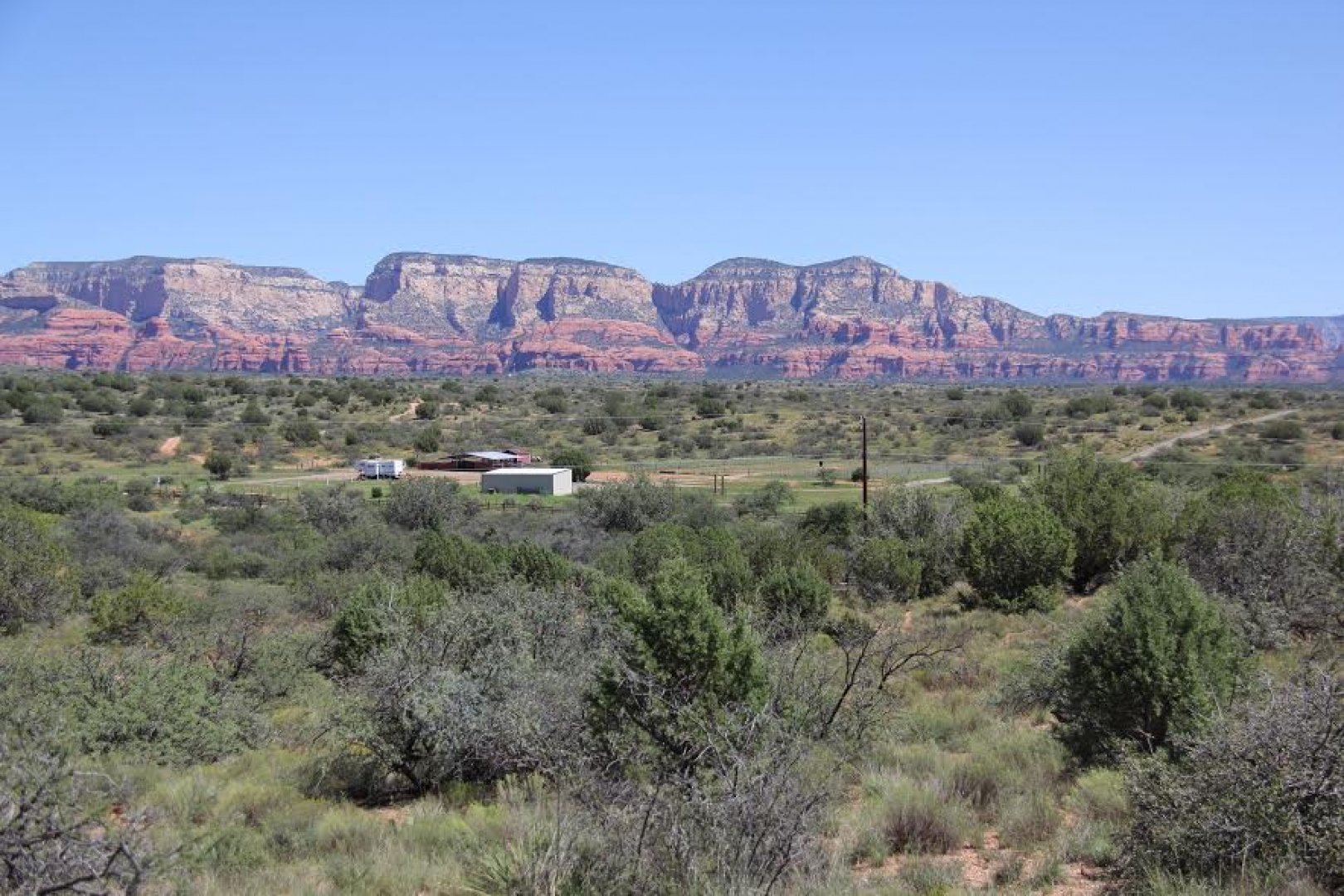
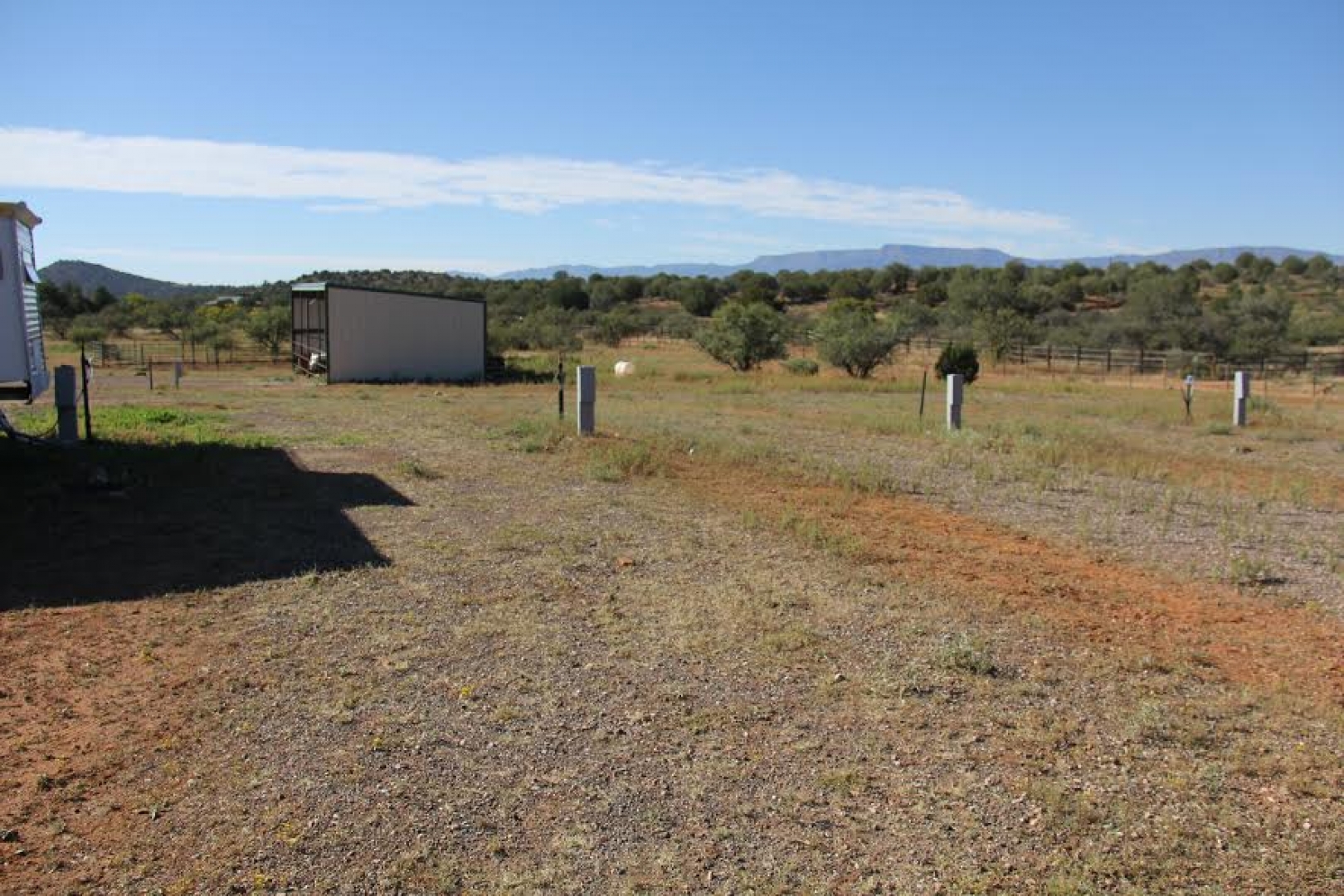
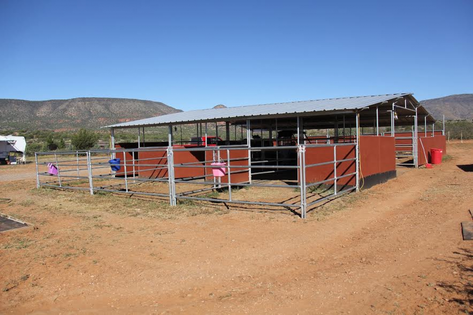
IMPROVEMENTSThe horse related improvements include the following: 12 X 16 Tack Room, 36 X 36 covered six stall Mare Motel with an additional 12 area on each side which is uncovered, 20 X 40 covered metal Hay Barn with dirt floor and open on the east side, 135 X 243 Arena with stripping chute, 10 return alley and roping box & chute, and four RV hookups with power, water & septic available.
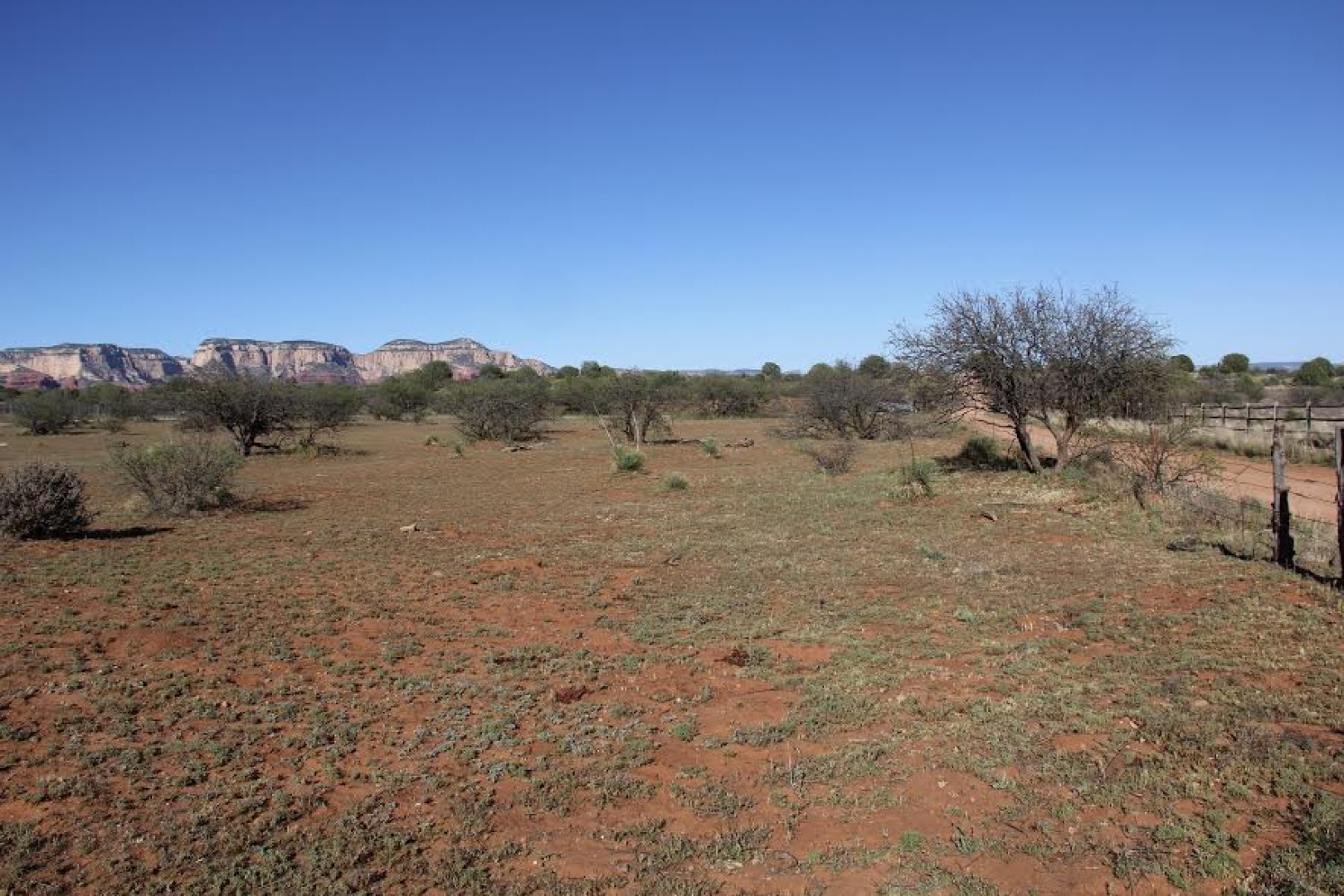
Fencing improvements are typical consisting of perimeter barbwire fencing and interior cross fencing into 5 pastures/paddocks of varied size. Each has water provided by the well.
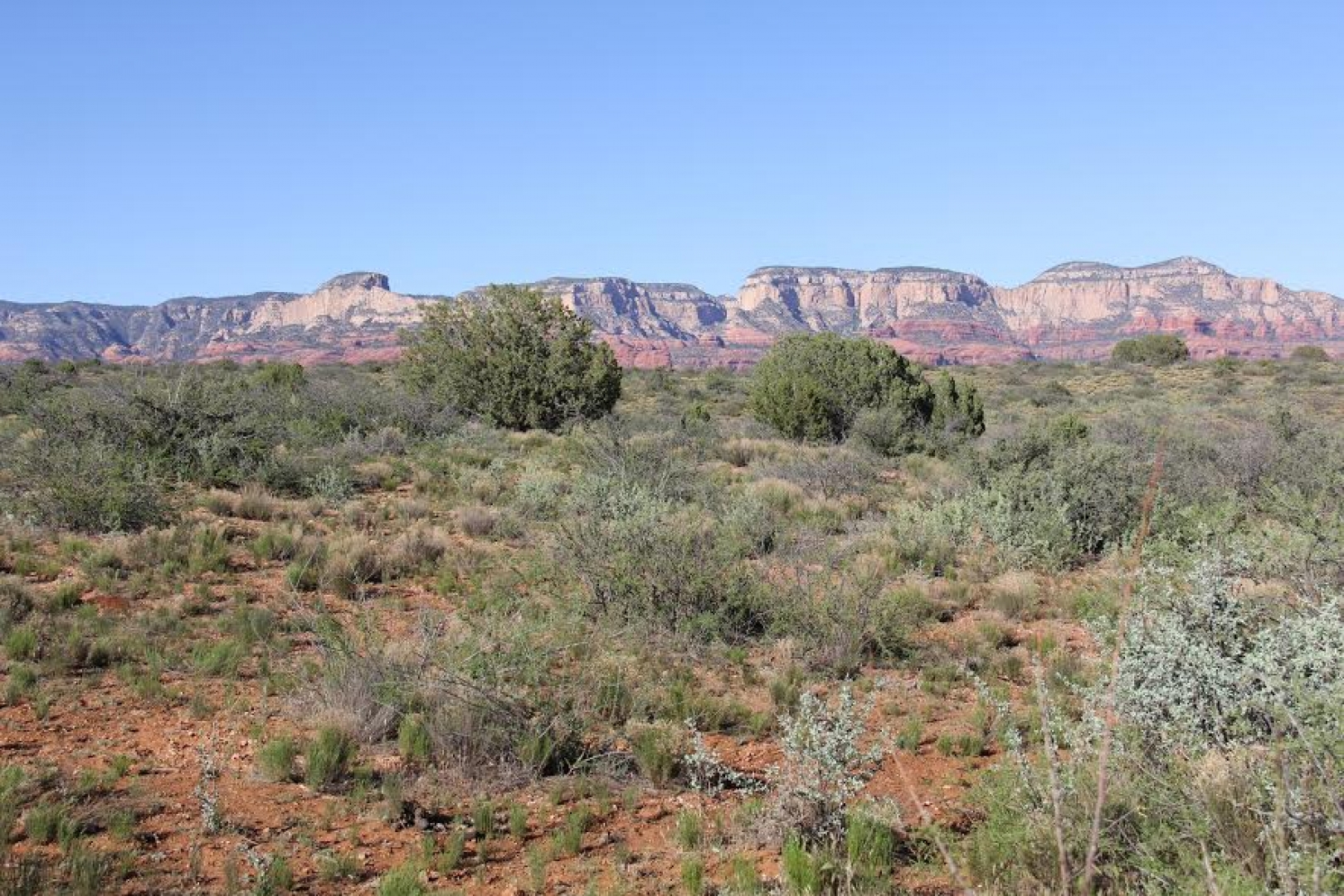
ELEVATION, Elevation ranges from 4,320 in the southwestern corner to 4,400 in the TOPOGRAPHYnortheastern corner. Topography is sloping to rolling hillside. Native vegetation VEGETATIONis Desert Grassland with scattered Jumper.
WATERDomestic and livestock water is furnished by a private well, Registration No. 55-910943. The AZ Department of Water Resources records show the well is 1,320 feet deep, with 10 inch steel casing, static water level is 820 feet and pumps greater than 35 gallons per minute (GPM). Date Measured - 11/5/2009.
The well is equipped with a submergible pump powered by a private generator.
The storage tank has a 5,000 gallon capacity.
Livestock water is distributed by pipe lines to the barn and water troughs.
SOILSContinental-Whitlock-Cave association. Moderately coarse and fine-textured soils with cemented lime layers at moderate to shallow depths.
CLIMATEThe Sedona Ranger Station reports the average annual rainfall is 17.15 inches and average annual snowfall is 8.8 inches. The January average maximum temperature is 55.0 and the average minimum is 29.7. The July average maximum temperature is 95.1 and the average minimum is 65.1
UTILITIESArea is serviced APS electricity and Century Link telephone.
ZONINGYavapai County: RCU-2A, Residential; rural zoning district with a 2-acre minimum lot size per dwelling.
FLOOD ZONEThe property is 100% Flood Zone D.
Zone D: areas in which flood hazards are undetermined, but possible. FEMA Panel N0. 1100 of 3900, Map Revised September 3, 2010.
MINERAL AND All mineral and water rights owned to be conveyed.
WATER RIGHTS
SCHOOLS Elementary through Junior High students attend West Sedona School. High School students attend Sedona High School.
PRICE$4,200,000
TERMSCash
REMARKS The Ranch is less than a 2 hour drive from downtown Phoenix and the Phoenix Airport.
The McCauley Property is situated in a popular area of the state and offers a pleasant year round climate.
The property is bordered on two sides by the Coconino National Forest.